

-
 OfertaProveedor:AeroNav Products
Carta de área terminal VFR de la FAA de Atlanta - del 14/05/26 al 09/07/26
Precio habitual $5.99Precio de oferta $5.99 Precio habitualPrecio unitario por$6.20 -
 OfertaProveedor:AeroNav Products
Carta de área terminal VFR de Houston de la FAA - 14/05/26 al 09/07/26
Precio habitual $5.99Precio de oferta $5.99 Precio habitualPrecio unitario por$6.20 -

Recién salido del hangar
Lo último de las mejores marcas de aviación. -
 OfertaProveedor:AeroNav Products
Carta del área terminal VFR de Los Ángeles de la FAA - del 14/05/26 al 09/07/26
Precio habitual $5.99Precio de oferta $5.99 Precio habitualPrecio unitario por$6.20 -
 OfertaProveedor:AeroNav Products
Carta de Área Terminal VFR de la FAA San Francisco - 14/05/26 al 09/07/26
Precio habitual $5.99Precio de oferta $5.99 Precio habitualPrecio unitario por$6.20 -
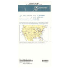 OfertaProveedor:AeroNav Products
Carta de área terminal VFR de la FAA Charlotte - 14/05/26 al 09/07/26
Precio habitual $5.99Precio de oferta $5.99 Precio habitualPrecio unitario por$6.20 -
 OfertaProveedor:AeroNav Products
Carta de área terminal VFR de la FAA de Cincinnati - 14/05/26 al 09/07/26
Precio habitual $5.99Precio de oferta $5.99 Precio habitualPrecio unitario por$6.20 -
 OfertaProveedor:AeroNav Products
FAA Dallas Ft. Worth Carta de Área Terminal VFR - 14/05/26 al 09/07/26
Precio habitual $5.99Precio de oferta $5.99 Precio habitualPrecio unitario por$6.20 -
 OfertaProveedor:AeroNav Products
Carta de área terminal VFR de la FAA Chicago - 14/05/26 al 09/07/26
Precio habitual $5.99Precio de oferta $5.99 Precio habitualPrecio unitario por$6.20 -
 OfertaProveedor:AeroNav Products
Carta de área terminal VFR de la FAA Tampa/Orlando - 14/05/26 al 09/07/26
Precio habitual $5.99Precio de oferta $5.99 Precio habitualPrecio unitario por$6.20 -
 OfertaProveedor:AeroNav Products
Carta del Área Terminal VFR de San Diego de la FAA - 14/05/26 al 09/07/26
Precio habitual $5.99Precio de oferta $5.99 Precio habitualPrecio unitario por$6.20 -
 OfertaProveedor:AeroNav Products
Carta del Área Terminal VFR de la FAA de Nueva York - 14/05/26 al 09/07/26
Precio habitual $5.99Precio de oferta $5.99 Precio habitualPrecio unitario por$6.20 -
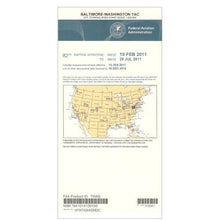 OfertaProveedor:AeroNav Products
FAA Baltimore - Washington VFR Terminal Area Chart - 26/05/14 al 26/07/09
Precio habitual $5.99Precio de oferta $5.99 Precio habitualPrecio unitario por$6.20 -
 OfertaProveedor:AeroNav Products
Carta de Área Terminal VFR de Cleveland de la FAA - 14/05/26 al 09/07/26
Precio habitual $5.99Precio de oferta $5.99 Precio habitualPrecio unitario por$6.20 -
 OfertaProveedor:AeroNav Products
Carta de área terminal VFR de la FAA de Salt Lake City - 26/05/14 al 26/07/09
Precio habitual $5.99Precio de oferta $5.99 Precio habitualPrecio unitario por$6.20 -
 OfertaProveedor:AeroNav Products
Carta de Área Terminal VFR de la FAA de Puerto Rico - 14/05/26 al 09/07/26
Precio habitual $5.99Precio de oferta $5.99 Precio habitualPrecio unitario por$15.35 -
 OfertaProveedor:AeroNav Products
Carta de área terminal VFR de la FAA de Pittsburgh - 14/05/26 al 09/07/26
Precio habitual $5.99Precio de oferta $5.99 Precio habitualPrecio unitario por$6.20 -
 OfertaProveedor:AeroNav Products
Carta de área terminal VFR de la FAA de Minneapolis - del 14/05/26 al 09/07/26
Precio habitual $5.99Precio de oferta $5.99 Precio habitualPrecio unitario por$6.20 -
 OfertaProveedor:AeroNav Products
Carta de Área Terminal VFR de la FAA de Detroit - 14/05/26 al 09/07/26
Precio habitual $5.99Precio de oferta $5.99 Precio habitualPrecio unitario por$6.20 -
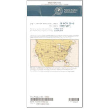 OfertaProveedor:AeroNav Products
Carta del Área Terminal VFR de Boston de la FAA - 14/05/26 al 09/07/26
Precio habitual $5.99Precio de oferta $5.99 Precio habitualPrecio unitario por$6.20 -
 OfertaProveedor:AeroNav Products
Carta de área terminal VFR de la FAA de Nueva Orleans - 14/05/26 al 09/07/26
Precio habitual $5.99Precio de oferta $5.99 Precio habitualPrecio unitario por$6.20 -
 OfertaProveedor:AeroNav Products
Carta de Área Terminal VFR de la FAA de Miami - 14/05/26 al 09/07/26
Precio habitual $5.99Precio de oferta $5.99 Precio habitualPrecio unitario por$6.20 -
 OfertaProveedor:AeroNav Products
Carta de Área Terminal VFR de la FAA de St Louis - 14/05/26 al 09/07/26
Precio habitual $5.99Precio de oferta $5.99 Precio habitualPrecio unitario por$6.20 -
 OfertaProveedor:AeroNav Products
Carta de área terminal VFR de Seattle de la FAA - 26/05/14 al 26/07/09
Precio habitual $5.99Precio de oferta $5.99 Precio habitualPrecio unitario por$6.20 -
 OfertaProveedor:AeroNav Products
Carta de área terminal VFR de la FAA de Phoenix - del 14/05/26 al 09/07/26
Precio habitual $5.99Precio de oferta $5.99 Precio habitualPrecio unitario por$6.20


FAA VFR Terminal Area Charts for Class B and Class C airspace
A VFR Terminal Area Chart, commonly called a TAC, is a large-scale aeronautical chart the FAA publishes for the metro areas built around major Class B airspace and the surrounding Class C. Drawn at 1:250,000, where about one inch equals 3.43 nautical miles, a TAC gives you roughly twice the detail of a 1:500,000 sectional. That extra resolution is what makes the stacked shelves of Class B, the VFR transition routes and flyways, the radio frequencies, the obstructions, and the visual checkpoints easy to read in a busy terminal environment. Pilot Mall stocks current-cycle Terminal Area Charts from AeroNav Products, dated to the active FAA effective period, so you can carry the right chart for the airspace you actually fly.
At a glance: major-metro Terminal Area Charts
| Terminal Area Chart | Region | Primary Class B airspace |
|---|---|---|
| New York TAC | Northeast | New York metro (JFK, LGA, EWR) |
| Boston TAC | Northeast | Boston metro (BOS) |
| Baltimore-Washington TAC | Mid-Atlantic | Washington and Baltimore metro (DCA, IAD, BWI) |
| Atlanta TAC | Southeast | Atlanta metro (ATL) |
| Miami TAC | Southeast | Miami metro (MIA) |
| Chicago TAC | Midwest | Chicago metro (ORD, MDW) |
| Denver TAC | Mountain West | Denver metro (DEN) |
| Dallas-Ft. Worth TAC | South Central | Dallas-Fort Worth metro (DFW, DAL) |
| Phoenix TAC | Southwest | Phoenix metro (PHX) |
| Los Angeles TAC | West Coast | Los Angeles basin (LAX) |
| San Francisco TAC | West Coast | San Francisco Bay (SFO, OAK, SJC) |
| Seattle TAC | Pacific Northwest | Seattle metro (SEA) |
The FAA publishes a TAC for roughly 30 metro areas in total, including Houston, Charlotte, San Diego, Las Vegas, and others. Click any product for current pricing.
What a Terminal Area Chart shows
Class B airspace structure
Class B airspace is often pictured as an upside-down wedding cake, with rings that step outward and upward from the primary airport. On a sectional those layers can run together, but the larger TAC scale separates each shelf with its own floor and ceiling clearly labeled, so you can stay legally below or outside the airspace, or request a clearance through it, without guesswork.
VFR transition routes and flyways
Many TACs depict VFR transition routes and VFR flyways, the published corridors that let you cross or skirt busy Class B with recommended altitudes and frequencies. These routes are far easier to follow on a TAC than on a sectional, and they help you plan a predictable path that keeps you clear of arrival and departure flows.
Frequencies, landmarks, and obstructions
Because a TAC packs more detail into the same area, it shows tower and approach frequencies, prominent visual landmarks, towers and other obstructions, and nav aids with the clarity you need when the workload is high. That density is exactly why a TAC is the preferred chart for VFR operations inside and around the terminal area.
How to choose the right Terminal Area Chart
- Match the chart to your airspace: order the TAC for the Class B metro you are flying into or near. If your route never enters a charted terminal area, a VFR sectional may be all you need.
- Buy the current cycle: each chart is printed with an FAA effective date and an expiration date. Order the edition that is current for your flight so airspace, frequencies, and obstructions are up to date.
- Plan long trips with both charts: a TAC covers the close-in detail while the surrounding sectional carries the en route picture, so cross-country flyers often carry the pair.
- Add IFR coverage if needed: instrument-rated pilots can pair a TAC with IFR enroute low altitude charts for the same area.
- Round out the kit: keep your charts organized and protected with chart accessories, and reference field data in the FAA Chart Supplements.
Heading north of the lower 48? See our dedicated Alaska charts, and browse the full range of FAA VFR publications for sectionals, TACs, and supplements in one place.
Why buy from Pilot Mall
- Aviation-only focus: we sell pilot gear and charts and nothing else, so every chart is the genuine FAA-published edition.
- Trusted for more than 25 years by student, recreational, and professional pilots.
- Free U.S. shipping over $100.
- Expert guidance from a team that flies and knows the charts.
Frequently Asked Questions
What is a VFR Terminal Area Chart?
A VFR Terminal Area Chart, or TAC, is a large-scale FAA aeronautical chart published for metro areas with major Class B airspace. Drawn at 1:250,000, it shows the layered Class B shelves, VFR transition routes, frequencies, landmarks, and obstructions in greater detail than a sectional for safe terminal-area flying.
What is the difference between a Terminal Area Chart and a sectional chart?
A sectional is drawn at 1:500,000 and covers a large area for en route navigation, while a Terminal Area Chart is drawn at 1:250,000 and covers a single Class B metro in about twice the detail. The TAC is published only for select cities and makes complex terminal airspace far easier to read.
What scale is a VFR Terminal Area Chart?
A VFR Terminal Area Chart is drawn at a scale of 1:250,000, where roughly one inch equals 3.43 nautical miles. That is about twice the scale of a 1:500,000 sectional, so the TAC fits more detail into a smaller area and makes Class B shelves, routes, and obstructions easier to interpret.
How often are VFR Terminal Area Charts updated?
The FAA revises VFR Terminal Area Charts on the standard 56-day chart cycle, the same schedule used for sectionals. Each chart carries an effective date and an expiration date, so order the current edition for your route. The Puerto Rico-Virgin Islands TAC is the exception and is updated annually.
When should I use a Terminal Area Chart instead of a sectional?
Use a Terminal Area Chart whenever you operate within or near the Class B airspace it covers, because the larger scale makes the stacked shelves and VFR routes much clearer. For en route legs outside a charted terminal area, a sectional gives you the wider view, so many pilots carry both.
Do I still need a paper Terminal Area Chart if I use ForeFlight?
An electronic flight bag like ForeFlight is excellent, but a current paper Terminal Area Chart is a smart cockpit backup if a tablet overheats, loses power, or fails. Many pilots keep a paper TAC for the busiest airspace they fly so they are never without a readable chart when workload is high.
