

-
 SaleVendor:AeroNav Products
FAA Seward VFR Sectional Chart for Alaska Pilots - 05/14/26 thru 07/09/26
Regular price $7.50Sale price $7.50 Regular priceUnit price per$7.55 -
 SaleVendor:AeroNav Products
FAA Mcgrath VFR Sectional Aeronautical Chart - 05/14/26 thru 07/09/26
Regular price $7.50Sale price $7.50 Regular priceUnit price per$7.55 -

Fresh from The Hangar
The latest from top aviation brands. -
 SaleVendor:AeroNav Products
FAA Fairbanks VFR Sectional Chart for Alaska Pilots - 05/14/26 thru 07/09/26
Regular price $7.50Sale price $7.50 Regular priceUnit price per$7.55 -
 SaleVendor:AeroNav Products
FAA Anchorage VFR Sectional Chart for Alaska Pilots - 05/14/26 thru 07/09/26
Regular price $7.50Sale price $7.50 Regular priceUnit price per$7.55 -
 SaleVendor:AeroNav Products
FAA Nome VFR Sectional Chart for Alaska Pilots - 05/14/26 thru 07/09/26
Regular price $7.50Sale price $7.50 Regular priceUnit price per$7.55 -
 SaleVendor:AeroNav Products
FAA Kodiak VFR Sectional Chart for Alaska Pilots - 05/14/26 thru 07/09/26
Regular price $7.50Sale price $7.50 Regular priceUnit price per$7.55 -
 SaleVendor:AeroNav Products
FAA Bethel VFR Sectional Chart for Alaska Pilots - 05/14/26 thru 07/09/26
Regular price $7.50Sale price $7.50 Regular priceUnit price per$7.55 -
 SaleVendor:AeroNav Products
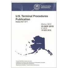
FAA Alaska Terminal Procedures Bound for Alaska Pilots - 05/14/26 thru 07/09/26
Regular price $12.50Sale price $12.50 Regular priceUnit price per$13.00 -
 SaleVendor:AeroNav Products
FAA Enroute Low Alaska L3/4 Low Altitude IFR Chart for Alaska Pilots - 05/14/26 thru 07/09/26
Regular price $5.00Sale price $5.00 Regular priceUnit price per$5.25 -
 SaleVendor:AeroNav Products
FAA Enroute Low Alaska L1/2 Low Altitude IFR Chart for Alaska Pilots - 05/14/26 thru 07/09/26
Regular price $5.00Sale price $5.00 Regular priceUnit price per$5.25 -
 SaleVendor:AeroNav Products
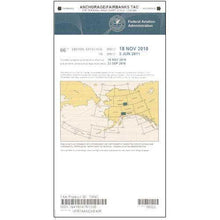
FAA Anchorage/Fairbanks Terminal Area Chart for Alaska Pilots - 05/14/26 thru 07/09/26
Regular price $5.99Sale price $5.99 Regular priceUnit price per$6.20 -
 SaleVendor:AeroNav Products
FAA Western Aleutian Islands VFR Sectional Chart for Alaska Pilots - 05/14/26 thru 07/09/26
Regular price $7.50Sale price $7.50 Regular priceUnit price per$7.55 -
 SaleVendor:AeroNav Products
FAA Ketchikan VFR Sectional Chart for Alaska Pilots - 05/14/26 thru 07/09/26
Regular price $7.50Sale price $7.50 Regular priceUnit price per$7.55 -
 SaleVendor:AeroNav Products
FAA Juneau VFR Sectional Chart for Alaska Pilots - 05/14/26 thru 07/09/26
Regular price $7.50Sale price $7.50 Regular priceUnit price per$7.55 -
 SaleVendor:AeroNav Products
FAA Dutch Harbor VFR Sectional Chart for Alaska Pilots - 05/14/26 thru 07/09/26
Regular price $7.50Sale price $7.50 Regular priceUnit price per$7.55 -
 SaleVendor:AeroNav Products
FAA Dawson VFR Sectional Chart for Alaska Pilots - 05/14/26 thru 07/09/26
Regular price $7.50Sale price $7.50 Regular priceUnit price per$7.55 -
 SaleVendor:AeroNav Products
FAA Cold Bay VFR Sectional Chart for Alaska Pilots - 05/14/26 thru 07/09/26
Regular price $7.50Sale price $7.50 Regular priceUnit price per$7.55 -
 SaleVendor:AeroNav Products
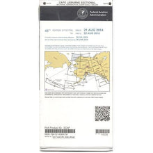
FAA Cape Lisburne VFR Sectional Chart for Alaska Pilots - 05/14/26 thru 07/09/26
Regular price $7.50Sale price $7.50 Regular priceUnit price per$7.55


FAA Alaska sectional and IFR charts for every region of the state
Alaska is large enough that no single chart can show it, so the FAA divides the state into regional VFR sectionals, supports the two busiest metropolitan areas with a terminal area chart, and serves instrument pilots with enroute low charts and a bound terminal procedures volume. The regional sectionals here cover Anchorage, Fairbanks, Juneau, Ketchikan, Kodiak, Nome, Seward, McGrath, the Western Aleutian Islands, and more, each drawn at the standard 1:500,000 scale for visual navigation. Because flying conditions and obstacles in Alaska change on their own timeline, most Alaska sectionals are revised annually rather than on the 56-day cycle used across the lower 48, so confirm the effective and expiration dates before you launch. Click any product for current pricing.
Alaska charts at a glance
| Chart | Type | Best for |
|---|---|---|
| Anchorage VFR Sectional | VFR sectional (1:500,000) | South-central Alaska and the busy Anchorage corridor |
| Fairbanks VFR Sectional | VFR sectional (1:500,000) | Interior Alaska and the Fairbanks area |
| Juneau VFR Sectional | VFR sectional (1:500,000) | Southeast Alaska and the inside passage |
| Kodiak VFR Sectional | VFR sectional (1:500,000) | Kodiak Island and the western Gulf of Alaska |
| Nome VFR Sectional | VFR sectional (1:500,000) | The Seward Peninsula and western coast |
| Western Aleutian Islands VFR Sectional | VFR sectional (1:500,000) | The far western Aleutian chain |
| Anchorage/Fairbanks Terminal Area Chart | Terminal area chart (1:250,000) | Detailed Class B and C airspace near Anchorage and Fairbanks |
| Alaska L1/L2 Enroute Low | IFR enroute low | Instrument flying on Alaska low-altitude airways |
| Alaska Terminal Procedures (Bound) | IFR terminal procedures | Approach, departure, and arrival plates statewide |
Click any product for current pricing.
Types of Alaska charts
VFR sectional charts
Sectional charts are the workhorse of visual flying. Drawn at 1:500,000 scale, each one shows airports, controlled and special-use airspace, NAVAIDs, obstructions, terrain relief, and visual checkpoints for one region of Alaska. We stock the regional sectionals including Anchorage, Fairbanks, Juneau, Ketchikan, Kodiak, Nome, Seward, McGrath, and the Western Aleutian Islands, so you can carry just the panels your route crosses.
Terminal area chart
The combined Anchorage/Fairbanks terminal area chart zooms in to 1:250,000 scale, twice the detail of a sectional, to make the busier Class B and Class C airspace around those cities easier to read. If you train, base, or transition near Anchorage or Fairbanks, the terminal area chart complements the sectional rather than replacing it.
IFR enroute low and terminal procedures
Instrument pilots fly the airway structure, not the visual landscape. The Alaska L1/L2 and L3/L4 enroute low charts show victor and T-route airways, minimum altitudes, fixes, and frequencies for low-altitude IFR, and the Alaska terminal procedures bound volume collects the approach, departure, and arrival plates you need at the destination.
How to choose the right Alaska chart
Start with how you fly. If you navigate visually, pick the VFR sectionals whose coverage your route crosses; a single trip across Alaska may need two or three adjacent panels. Match the chart to your region: the Anchorage sectional covers the south-central corridor, Fairbanks covers the interior, Juneau and Ketchikan cover the southeast panhandle, and Nome, Kodiak, Seward, McGrath, and the Western Aleutian Islands handle the western, island, and remote reaches. If you operate near Anchorage or Fairbanks, add the larger-scale terminal area chart for cleaner airspace detail. IFR pilots will want the L1/L2 and L3/L4 enroute low set plus the bound terminal procedures volume. Whatever you choose, check the effective date and keep a current paper chart aboard as a backup to your tablet. For everything beyond Alaska, browse the full FAA aeronautical charts hub and the conterminous VFR terminal area charts.
Why buy from Pilot Mall
- Aviation only: we sell pilot gear and nothing else, so our team knows how Alaska charts fit real cross-country and bush missions.
- Current FAA editions: we carry genuine FAA-published charts so you fly the official, up-to-date revision.
- Trusted for 25-plus years: thousands of pilots rely on Pilot Mall for charts and cockpit supplies.
- Free U.S. shipping over $100: stock up on the panels your routes cross and qualify on larger orders.
- Expert guidance: talk to people who fly before you buy.
Frequently Asked Questions
How many sectional charts does it take to cover Alaska?
It takes 16 VFR sectional charts to cover the entire state of Alaska, which is more than any other state requires. Most pilots do not need all of them at once; you carry only the regional sectionals whose coverage your planned route crosses, often just two or three adjacent panels for a given trip.
How often are Alaska sectional charts updated?
Most Alaska sectional charts are revised on an annual cycle, unlike the 56-day cycle used for sectionals across the conterminous United States. Always check the effective and expiration dates printed on the chart and fly the current edition, since airspace, obstructions, and frequencies can change between revisions.
What is the difference between a VFR sectional and a terminal area chart?
A VFR sectional is drawn at 1:500,000 scale and covers a wide region for general visual navigation. A terminal area chart is drawn at 1:250,000 scale, showing twice the detail to make busy Class B and Class C airspace easier to read. In Alaska the terminal area chart covers the Anchorage and Fairbanks areas.
Which Alaska sectional chart do I need for my flight?
Choose the sectional whose coverage area includes your route. Anchorage covers the south-central corridor, Fairbanks the interior, Juneau and Ketchikan the southeast panhandle, and Nome, Kodiak, Seward, McGrath, and the Western Aleutian Islands the western and remote regions. A longer trip may cross two or three adjacent panels, so carry each one your route touches.
What scale are Alaska VFR sectional charts?
Alaska VFR sectional charts use the standard 1:500,000 scale, the same scale as sectionals in the rest of the United States. At that scale one inch represents about 6.86 nautical miles, giving enough detail to show airports, airspace, NAVAIDs, obstructions, terrain relief, and visual checkpoints across a wide region.
Do I still need paper charts if I fly with an EFB or ForeFlight?
A tablet electronic flight bag is convenient, but a current paper chart is a smart backup. Screens overheat, batteries drain, and apps crash, so many pilots carry the relevant paper sectional and approach plates aboard. In remote Alaska, where help is far away, a paper backup is especially worth the small space it takes.
