

-
 SaleVendor:AeroNav Products
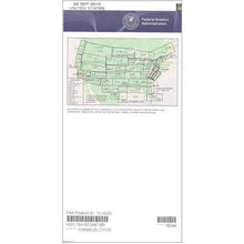
FAA L21/22 Instrument Flight Rules (IFR) Enroute Low Altitude Chart - 05/14/26 thru 07/09/26
Regular price $5.00Sale price $5.00 Regular priceUnit price per$5.25 -
 SaleVendor:AeroNav Products
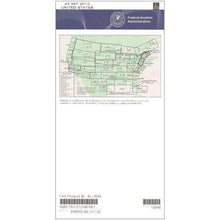
FAA L23/24 Instrument Flight Rules (IFR) Enroute Low Altitude Chart - 05/14/26 thru 07/09/26
Regular price $5.00Sale price $5.00 Regular priceUnit price per$5.25 -

Fresh from The Hangar
The latest from top aviation brands. -
 SaleVendor:AeroNav Products
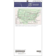
FAA L3/4 Instrument Flight Rules (IFR) Enroute Low Altitude Chart - 05/14/26 thru 07/09/26
Regular price $5.00Sale price $5.00 Regular priceUnit price per$5.25 -
 SaleVendor:AeroNav Products
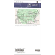
FAA L27/28 Instrument Flight Rules (IFR) Enroute Low Altitude Chart - 05/14/26 thru 07/09/26
Regular price $5.00Sale price $5.00 Regular priceUnit price per$5.25 -
 SaleVendor:AeroNav Products
FAA L35/36 Instrument Flight Rules (IFR) Enroute Low Altitude Chart - 05/14/26 thru 07/09/26
Regular price $5.00Sale price $5.00 Regular priceUnit price per$5.25 -
 SaleVendor:AeroNav Products
FAA L33/34 Instrument Flight Rules (IFR) Enroute Low Altitude Chart - 05/14/26 thru 07/09/26
Regular price $5.00Sale price $5.00 Regular priceUnit price per$5.25 -
 SaleVendor:AeroNav Products
FAA L17/18 Instrument Flight Rules (IFR) Enroute Low Altitude Chart - 05/14/26 thru 07/09/26
Regular price $5.00Sale price $5.00 Regular priceUnit price per$5.25 -
 SaleVendor:AeroNav Products
FAA L31/32 Instrument Flight Rules (IFR) Enroute Low Altitude Chart - 05/14/26 thru 07/09/26
Regular price $5.00Sale price $5.00 Regular priceUnit price per$5.25 -
 SaleVendor:AeroNav Products
FAA L29/30 Instrument Flight Rules (IFR) Enroute Low Altitude Chart - 05/14/26 thru 07/09/26
Regular price $5.00Sale price $5.00 Regular priceUnit price per$5.25 -
 SaleVendor:AeroNav Products
FAA L25/26 Instrument Flight Rules (IFR) Enroute Low Altitude Chart - 05/14/26 thru 07/09/26
Regular price $5.00Sale price $5.00 Regular priceUnit price per$5.25 -
 SaleVendor:AeroNav Products
FAA L19/20 Instrument Flight Rules (IFR) Enroute Low Altitude Chart - 05/14/26 thru 07/09/26
Regular price $5.00Sale price $5.00 Regular priceUnit price per$5.25 -
 SaleVendor:AeroNav Products
FAA L15/16 Instrument Flight Rules (IFR) Enroute Low Altitude Chart - 05/14/26 thru 07/09/26
Regular price $5.00Sale price $5.00 Regular priceUnit price per$5.25 -
 SaleVendor:AeroNav Products
FAA L13/14 Instrument Flight Rules (IFR) Enroute Low Altitude Chart - 05/14/26 thru 07/09/26
Regular price $5.00Sale price $5.00 Regular priceUnit price per$5.25 -
 SaleVendor:AeroNav Products
FAA L11/12 Instrument Flight Rules (IFR) Enroute Low Altitude Chart - 05/14/26 thru 07/09/26
Regular price $5.00Sale price $5.00 Regular priceUnit price per$5.25 -
 SaleVendor:AeroNav Products
FAA L9/10 Instrument Flight Rules (IFR) Enroute Low Altitude Chart - 05/14/26 thru 07/09/26
Regular price $5.00Sale price $5.00 Regular priceUnit price per$5.25 -
 SaleVendor:AeroNav Products
FAA L7/8 Instrument Flight Rules (IFR) Enroute Low Altitude Chart - 05/14/26 thru 07/09/26
Regular price $5.00Sale price $5.00 Regular priceUnit price per$5.25 -
 SaleVendor:AeroNav Products
FAA L5/6 Instrument Flight Rules (IFR) Enroute Low Altitude Chart - 05/14/26 thru 07/09/26
Regular price $5.00Sale price $5.00 Regular priceUnit price per$5.25 -
 SaleVendor:AeroNav Products
FAA L1/2 Instrument Flight Rules (IFR) Enroute Low Altitude Chart - 05/14/26 thru 07/09/26
Regular price $5.00Sale price $5.00 Regular priceUnit price per$5.25


IFR enroute low altitude charts: how to choose the right panels
IFR enroute low altitude charts, often called low enroute charts, are the four-color FAA charts instrument pilots use to navigate the airway structure below 18,000 feet MSL. The conterminous United States is divided into numbered panels, and each panel is printed front and back as an odd and even pair. The goal when buying is simple: cover your route from takeoff to landing, including the panels your airways cross along the way. The table below maps each panel pair to the part of the country it covers so you can choose with confidence.
| Panel pair | General coverage area | Link |
|---|---|---|
| L1/2, L3/4 | West Coast, Pacific Northwest, California | L1/2 · L3/4 |
| L5/6, L7/8, L9/10 | Rocky Mountains and desert Southwest | L5/6 · L7/8 · L9/10 |
| L11/12, L13/14, L15/16, L17/18 | Northern plains, Midwest, Great Lakes | L11/12 · L13/14 · L15/16 · L17/18 |
| L19/20, L21/22, L23/24 | Southeast and Gulf states | L19/20 · L21/22 · L23/24 |
| L25/26, L27/28, L33/34 | Northeast corridor and Mid-Atlantic | L25/26 · L27/28 · L33/34 |
| L29/30, L31/32, L35/36 | Remaining conterminous panels for full national coverage | L29/30 · L31/32 · L35/36 |
Coverage areas above are approximate and panels overlap at their edges, so confirm the exact boundary against the panel index before a long cross-country.
What is on a low altitude chart
Every low altitude panel shows the same family of instrument flight rules information. Victor airways connect VOR navaids in a low-altitude route network, each labeled with its MEA, and many segments also carry a MOCA, a minimum crossing altitude (MCA), or a changeover point. Navaid boxes list VOR, VORTAC, and NDB identifiers, frequencies, and Morse code. The charts also depict intersections, holding patterns, controlled airspace, ARTCC frequencies and boundaries, and minimum off-route altitudes. Reading these symbols fluently is the heart of low-altitude IFR navigation and instrument cross-country planning.
How to choose your panels
Start with the panel that contains your home airport, then trace your typical routes. If your airways run off the edge of that panel, buy the adjacent panel too, because the FAA splits coverage along arbitrary panel lines rather than along your flight path. Pilots who fly regionally usually keep a small stack of three or four adjacent panels current, while pilots who travel nationally build out a broader set. Because these charts are revised every 56 days, plan to replace the panels you actively fly each cycle so your charts match the current airway data.
Why buy from Pilot Mall
- Full panel selection: every conterminous-US panel from L1/2 through L35/36 in one place, so you can assemble exactly the coverage your routes need.
- Current editions: charts published by AeroNav Products on the FAA's 56-day revision cycle.
- Aviation only: we sell pilot gear and nothing else, so our team understands charts, airways, and instrument flight planning.
- Free U.S. shipping over $100: grab every adjacent panel your region needs in a single order and qualify with ease.
- Trusted for 25-plus years: thousands of pilots rely on Pilot Mall for charts and cockpit equipment.
Frequently Asked Questions
What is an IFR enroute low altitude chart?
An IFR enroute low altitude chart is a four-color FAA aeronautical chart used to navigate under instrument flight rules below 18,000 feet MSL. It depicts Victor airways, VOR and other navaids, intersections, minimum enroute altitudes, ARTCC boundaries, and the communication and obstruction-clearance data instrument pilots need enroute.
How often are IFR enroute low altitude charts updated?
The FAA revises IFR enroute low altitude charts on a 56-day cycle, the same schedule used across the instrument chart product line. Each new edition reflects changes to airways, navaids, frequencies, and altitudes, so pilots should replace the panels they actively fly every cycle to stay current and legal.
Which IFR low altitude chart do I need for my route?
Choose the panel that contains your departure and destination, then add any adjacent panels your airways cross. The conterminous United States is split into numbered panels, so a single route can require two or more. Use the coverage table above to match each panel pair to its region.
What altitude do IFR low altitude charts cover?
Low altitude enroute charts cover instrument navigation below 18,000 feet MSL, the low-altitude airway structure built around Victor airways and VOR navaids. For flights at or above 18,000 feet MSL in the high-altitude jet-route structure, you need the IFR enroute high altitude charts instead.
How do you read an IFR enroute low altitude chart?
Follow the Victor airways between navaid boxes, reading the MEA printed along each segment and noting any MOCA, MCA, or changeover point. Use navaid boxes for frequencies and identifiers, intersections for position fixes, and the chart legend for airspace, holding patterns, and ARTCC boundary and frequency information.
What is the difference between IFR low and high altitude enroute charts?
Low altitude charts cover the Victor airway structure below 18,000 feet MSL, while high altitude charts cover the jet-route structure at and above 18,000 feet MSL up to FL450. Most piston and training instrument flying uses the low altitude charts; turbine flights in the flight levels use the high altitude charts.
