

-
 OfertaProveedor:AeroNav Products
Carta Aeronáutica Seccional VFR de Detroit de la FAA - del 14/05/26 al 09/07/26
Precio habitual $8.50Precio de oferta $8.50 Precio habitualPrecio unitario por$9.75 -
 OfertaProveedor:AeroNav Products
Carta Aeronáutica Seccional VFR FAA Montreal - 14/05/26 al 09/07/26
Precio habitual $8.50Precio de oferta $8.50 Precio habitualPrecio unitario por$9.75 -

Recién salido del hangar
Lo último de las mejores marcas de aviación. -
 OfertaProveedor:AeroNav Products
Carta Aeronáutica Seccional VFR de Green Bay de la FAA - del 14/05/26 al 09/07/26
Precio habitual $8.50Precio de oferta $8.50 Precio habitualPrecio unitario por$9.75 -
 OfertaProveedor:AeroNav Products
Carta Aeronáutica Seccional VFR de la FAA de Atlanta - 14/05/26 al 09/07/26
Precio habitual $8.50Precio de oferta $8.50 Precio habitualPrecio unitario por$9.75 -
 OfertaProveedor:AeroNav Products
Carta Aeronáutica Seccional VFR de Nueva York de la FAA - 14/05/26 al 09/07/26
Precio habitual $8.50Precio de oferta $8.50 Precio habitualPrecio unitario por$9.75 -
 OfertaProveedor:AeroNav Products
Carta Aeronáutica Seccional VFR de Jacksonville de la FAA - 14/05/26 al 09/07/26
Precio habitual $8.50Precio de oferta $8.50 Precio habitualPrecio unitario por$9.75 -
 OfertaProveedor:AeroNav Products
Carta Aeronáutica Seccional VFR de Miami de la FAA - 14/05/26 al 09/07/26
Precio habitual $8.50Precio de oferta $8.50 Precio habitualPrecio unitario por$9.75 -
 OfertaProveedor:AeroNav Products
Carta Aeronáutica Seccional VFR de la FAA de San Francisco - 14/05/26 al 09/07/26
Precio habitual $8.50Precio de oferta $8.50 Precio habitualPrecio unitario por$9.75 -
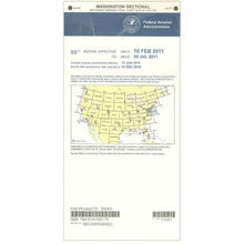 OfertaProveedor:AeroNav Products
Sección de Washington de la FAA - del 14/05/26 al 09/07/26
Precio habitual $8.50Precio de oferta $8.50 Precio habitualPrecio unitario por$9.75 -
 OfertaProveedor:AeroNav Products
Carta Aeronáutica Seccional VFR de la FAA de Los Ángeles - 14/05/26 al 09/07/26
Precio habitual $8.50Precio de oferta $8.50 Precio habitualPrecio unitario por$9.75 -
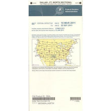 OfertaProveedor:AeroNav Products
Carta Aeronáutica Seccional VFR de la FAA de Dallas - 14/05/26 al 09/07/26
Precio habitual $8.50Precio de oferta $8.50 Precio habitualPrecio unitario por$9.75 -
 OfertaProveedor:AeroNav Products
Carta Aeronáutica Seccional VFR de Chicago de la FAA - 14/05/26 al 09/07/26
Precio habitual $8.50Precio de oferta $8.50 Precio habitualPrecio unitario por$9.75 -
 OfertaProveedor:AeroNav Products
Carta Aeronáutica Seccional VFR de la FAA de Seattle - 14/05/26 al 09/07/26
Precio habitual $8.50Precio de oferta $8.50 Precio habitualPrecio unitario por$9.75 -
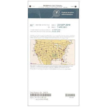 OfertaProveedor:AeroNav Products
Carta Aeronáutica Seccional VFR de la FAA de Memphis - 14/05/26 al 09/07/26
Precio habitual $8.50Precio de oferta $8.50 Precio habitualPrecio unitario por$9.75 -
 OfertaProveedor:AeroNav Products
Carta Aeronáutica Seccional VFR de la FAA de Charlotte - 14/05/26 al 09/07/26
Precio habitual $8.50Precio de oferta $8.50 Precio habitualPrecio unitario por$9.75 -
 OfertaProveedor:AeroNav Products
Carta Aeronáutica Seccional VFR de la FAA de St. Louis - 14/05/26 al 09/07/26
Precio habitual $8.50Precio de oferta $8.50 Precio habitualPrecio unitario por$9.75 -
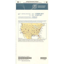 OfertaProveedor:AeroNav Products
Carta Aeronáutica Seccional VFR de la FAA de Houston - 14/05/26 al 09/07/26
Precio habitual $8.50Precio de oferta $8.50 Precio habitualPrecio unitario por$9.75 -
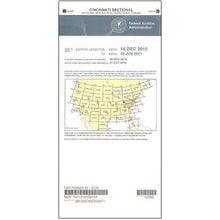 OfertaProveedor:AeroNav Products
Carta Aeronáutica Seccional VFR de la FAA de Cincinnati - 14/05/26 al 09/07/26
Precio habitual $8.50Precio de oferta $8.50 Precio habitualPrecio unitario por$9.75 -
 OfertaProveedor:AeroNav Products
Carta Aeronáutica Seccional VFR de la FAA de Salt Lake City - 14/05/26 al 09/07/26
Precio habitual $8.50Precio de oferta $8.50 Precio habitualPrecio unitario por$9.75 -
 OfertaProveedor:AeroNav Products
Carta Aeronáutica Seccional VFR de Omaha de la FAA - 14/05/26 al 09/07/26
Precio habitual $8.50Precio de oferta $8.50 Precio habitualPrecio unitario por$9.75 -
 OfertaProveedor:AeroNav Products
Carta Aeronáutica Seccional VFR de las Islas Hawaianas de la FAA - 14/05/26 al 09/07/26
Precio habitual $8.50Precio de oferta $8.50 Precio habitualPrecio unitario por$9.75 -
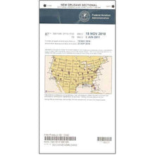 OfertaProveedor:AeroNav Products
Carta Aeronáutica Seccional VFR de la FAA de Nueva Orleans - del 14/05/26 al 09/07/26
Precio habitual $8.50Precio de oferta $8.50 Precio habitualPrecio unitario por$9.75 -
 OfertaProveedor:AeroNav Products
Carta aeronáutica seccional VFR de la FAA de Las Vegas - del 14/05/26 al 09/07/26
Precio habitual $8.50Precio de oferta $8.50 Precio habitualPrecio unitario por$9.75 -
 OfertaProveedor:AeroNav Products
Carta aeronáutica seccional VFR de la FAA de Kansas City - 14/05/26 al 09/07/26
Precio habitual $8.50Precio de oferta $8.50 Precio habitualPrecio unitario por$9.75


VFR Sectional Aeronautical Charts
A VFR sectional aeronautical chart is the core visual-navigation tool for flying under Visual Flight Rules. Each FAA sectional is drawn at 1:500,000 scale and packs terrain and obstacle elevations, airspace boundaries, radio frequencies, and airport data onto a single sheet, so you can plan a route, brief the airspace, and stay oriented in the cockpit. Every chart in this collection is a current FAA edition published on the standard 56-day revision cycle, and paper remains a reliable backup the day a tablet battery quits.
Find Your Region at a Glance
Each sectional is named for a major city near its center and covers the surrounding region. Pick the title that contains your route; a longer cross-country may span two adjoining charts.
| Sectional Chart | Coverage Centered On |
|---|---|
| Atlanta Sectional | Georgia and the Southeast |
| New York Sectional | New York and the Northeast |
| Chicago Sectional | Illinois and the Upper Midwest |
| Dallas Sectional | North Texas |
| Los Angeles Sectional | Southern California |
| Seattle Sectional | Washington and the Pacific Northwest |
| Miami Sectional | South Florida |
| Houston Sectional | Southeast Texas and the Gulf Coast |
Types of Aeronautical Charts
VFR Sectional Charts
The sectional is the everyday VFR planning chart, showing a wide region at 1:500,000 scale with terrain shading, obstacles, airspace, navaids, and airport details. It is what most pilots reach for first to lay out a cross-country route.
Terminal Area Charts
Around the busiest Class B airports, a terminal area chart zooms in to 1:250,000 for finer detail in congested airspace. Many pilots carry the matching terminal area chart alongside the sectional that covers the same city.
Supporting Publications
Round out the planning kit with the broader range of FAA charts and the regional Chart Supplements found in the Chart Supplements and Airport Facility Directories, which list airport services, frequencies, and procedures the sectional cannot fully detail.
How to Choose the Right Sectional Chart
- Match the chart to your region. Choose the titled sectional that contains your departure, route, and destination. Plan to carry both charts when a flight crosses the boundary between two adjoining sectionals.
- Check the effective date. The FAA revises VFR sectionals on a 56-day cycle, and the dates printed on the cover define the window the chart is legal and current for. Order the edition that covers the dates of your flight.
- Decide between a sectional and a terminal area chart. A sectional gives you the wide picture; a terminal area chart gives you fine detail near a major Class B airport. Busy-airspace flights often warrant both.
- Build the full cockpit kit. Plot your course with flight computers and plotters, organize the panel with cockpit supplies and a kneeboard, log the trip in a pilot logbook, and keep it all together in a flight bag.
Why Buy From Pilot Mall
- Aviation-only focus: we stock pilot gear and FAA charts, nothing else.
- Trusted by pilots for more than 25 years.
- Free U.S. shipping over $100.
- Expert guidance from a team that flies and knows the products.
Frequently Asked Questions
What are VFR sectional charts used for?
VFR sectional charts are used for visual navigation under Visual Flight Rules, giving pilots detailed terrain, obstacle, airspace, navaid, and airport information on a single 1:500,000-scale sheet so they can plan and fly a route while staying oriented and clear of controlled airspace.
How often are VFR sectional charts updated?
The FAA revises VFR sectional charts on a 56-day cycle, and the effective dates printed on the cover define the window the chart is current for, so pilots should always fly with the edition that covers the dates of their flight.
Which sectional chart should I buy for my region?
Buy the sectional titled for the major city nearest your route, since each chart is named for a city at its center and covers the surrounding region; a longer cross-country that crosses a chart boundary requires both adjoining sectionals.
What is the difference between a sectional chart and a terminal area chart?
A sectional chart shows a wide region at 1:500,000 scale for general VFR planning, while a terminal area chart zooms in to 1:250,000 around the busiest Class B airports for finer detail, and many pilots carry both for flights into congested airspace.
Can I use a VFR sectional chart for flight planning?
Yes, the VFR sectional chart is the foundational flight-planning tool for visual navigation, providing the topographic, airspace, and navigational detail needed to build a route, brief the airspace, and maintain situational awareness in flight.
