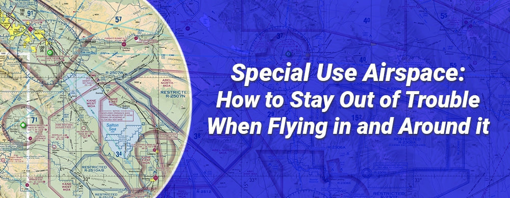
You’ve learned about the different classes of airspace plus the rules for entering each, so you may think you’re all set and ready to fly, but not so fast—there’s more.
Before you’re ready to take off on that cross-country flight or fly in to an airshow event, you also need to familiarize yourself with special use airspace.
Keep reading as we cover all types of special use airspace and what you as a pilot need to know so you stay out of trouble while flying in and around them.
Table of Contents
- What is a Special Use Area?
- Is Special Use Airspace Shown on Charts?
- The 8 Types of Special Use Airspace
- Prohibited Airspace
- Restricted Airspace
- Warning Areas
- Military Operation Areas (MOAs)
- Alert Areas
- Controlled Firing Areas
- National Security Areas
- Temporary Flight Restrictions (TFRs)
- Flying Through Special Use Airspace
 What is a Special Use Area?
Section 3-4-1 of the Aeronautical Information Manual (AIM) defines Special Use Airspace or “SUA” as “airspace wherein activities must be confined because of their nature, or wherein limitations are imposed upon aircraft operations that are not a part of those activities, or both.”
Is Special Use Airspace Shown on Charts?
Most special use airspace is depicted on aeronautical charts, but some is not. Controlled firing areas (CFAs), temporary military operations areas (MOAs), and temporary restricted areas are not on charts.
The 8 Types of Special Use Airspace
Special Use Airspace is divided into eight distinct categories, each with its own purpose and use/entry policies. The categories are:
- Prohibited Areas
- Restricted Airspace
- Warning Areas
- Military Operation Areas (MOAs)
- Alert Areas
- Controlled Firing Area (CFA)
- National Security Areas
- Temporary Flight Restrictions (TFRs)
 Prohibited Airspace
If you are here, you are probably flying too close to the White House or over Camp David and your intrusion will addressed shortly. Prohibited areas are just that. Stay out; you are not allowed to be in there.
These are areas where ALL flight is prohibited without exception due to “security or other reasons associated with the national welfare.”
All prohibited areas are published in the Federal Register and are shown on aeronautical charts with the letter “P” followed by a designation number and a circular blue border. Refer to the side of your corresponding sectional for more details.
 Restricted Airspace
In Section 3-4-3, the AIM says that “restricted areas denote the existence of unusual, often invisible, hazards to aircraft such as artillery firing, aerial gunnery, or guided missiles.”
Think of restricted airspace as an area that “may be hazardous to your health.” For example, flying through a restricted area can put you over a section of Area 51 where black helicopters will be soon escorting you down to a local field.
As the name implies, restricted airspace is not 100% off-limits to everyone, but you do have to ask for permissions and play by special rules to enter if the area is “hot” or “active.” VFR flights are almost always off-limits in active restricted airspace, but IFR flight plans may be approved at the discretion of the controlling agency.
Often if you’re not a part of the activities going on in a restricted airspace, you will only be allowed in the space if the restricted area is not currently active and it’s a joint-use airspace with control released back to the FAA.
If you’re thinking about navigating a restricted area, confirm the altitude restrictions, hours of use, and controlling agency so you can research and plan.
Permanent areas of restricted airspace are published in the Federal Registrar and on the relevant en route, VFR Terminal Area, and Sectional Aeronautical charts. Look for the letter “R” and a blue border with blue hash marks.
Pro Tip: Temporary restricted areas are not charted. As part of your flight planning and pre-flight procedure, check for NOTAMs, use the FAA Special Use Airspace site, or contact the ATC facilities overseeing the airspace on your flight path to ask about the presence of any temporary restricted airspace.
 Warning Areas
Warning areas are a type of special use airspace that contains “activity that may be hazardous to nonparticipating aircraft.” Warning areas can be found over domestic or international waters.
Warning areas are normally found along our coastal borders and extend outward 12 nautical miles. If warning areas are in international airspace, the United States does not have sole jurisdiction of said airspace.
If possible, keep it simple and avoid flying through a warning area. If you absolutely need to fly through a warning area, use the information on your chart to contact the controlling agency and confirm if the area is active. You can also call the FSS to confirm.
Warning areas show up on charts with the letter “W,” an associated number, and a hashed blue border.
 Military Operation Areas (MOAs)
Military Operations Areas can be both dangerous and fun. There is nothing like witnessing a jet come flying over you at 500+ miles per hour. Traversing MOAs can be like a pedestrian crossing the track at the Indy 500. You won’t see anything until it’s too late.
Military pilots use MOAs as areas to conduct activities like aerobatics, air combat training/practice, air intercepts, formation training, and low-altitude tactics. Within an MOA, military pilots are exempt from standard CFR provisions that limit airspeed and aerobatic flight.
MOAs also exist to separate IFR traffic from military aircraft. When an MOA is actively being used, ATC can clear IFR traffic through the area if separation can be provided. If not, ATC will restrict or reroute IFR traffic, so it does not interfere with the military exercise.
VFR flights are technically allowed within an MOA, and ATC contact is not even mandatory, but again, remember that you’re like a pedestrian deciding to cross the Indy racetrack. it’s important to know when the area is in operation.
You should be alert as an MOA’s status can suddenly and frequently change from inactive to active. Use extreme caution and contact the controlling agency for traffic advisories prior to entering an MOA. When in doubt, if the MOA is small enough, consider altering course and avoiding the area altogether rather than risk flying through it.
Permanent MOA information including their altitudes, contact frequencies, and operating times are depicted on sectionals, en route low altitude charts, and VFR Terminal Area charts. Temporary MOAs, on the other hand, are not charted.
 Alert Areas
Imagine taking a drive on any given Saturday and ending up in the local High School’s Driver’s Ed course. Is it a good idea to hang out here? Probably not. That is what comes to mind when we see Alert Areas on a chart. Those areas on the chart usually mean that there is a high volume of pilot training or other unusual aerial activity occurring.
No special permission is required to enter this type of special airspace, but if you choose to do so, be very alert and remember that the FAA holds all pilots in the area “equally responsible for collision avoidance.”
Pro Tip: When planning your flight, if you can’t easily fly around an alert area, check its altitude limits and consider flying above or below it.
Like the “student driver” placard on a driver’s ed car, alert areas are also labeled. Check your charts for the letter “A,” an associated number, and a hash marked magenta border.
 Controlled Firing Areas
MythBusters used to do some of their demo work at a firing range in the San Francisco Bay. There was one episode where they shot a cannonball or a bowling ball over a mountain (on accident) and it landed in someone’s home.
This would be an example of why you don’t want to be in an active Controlled Firing Area. These areas are where explosives and ordinance are cooked off by so-called professionals. Don’t get shot down—stay out of active CFAs.
The good news is that CFAs are relatively small and have spotter aircraft, radar, or ground lookouts watching for any incoming air traffic. Unlike other special use areas, activities within a CFA must be immediately suspended if a non-participating aircraft is spotted approaching the area.
CFAs aren’t shown on charts since nonparticipating aircraft aren’t required to change their flight paths, and the participants have to suspend all activities if aircraft approach.
 National Security Areas
A National Security Area (NSA), or as they are sometimes jokingly called, “No Such Area Exists,” are established over ground facilities that are of a sensitive nature that requires additional safety and security.
Pilots are “requested to voluntarily avoid flying through the depicted NSA.” While avoiding NSAs is usually only strongly recommended, flight in NSAs can also be temporary prohibited. If a temporary regulatory prohibition is issued it will be sent out via NOTAM.
Look for NSAs on your charts with thick, dashed magenta lines.
 Temporary Flight Restrictions (TFRs)
As the name implies, TFRs are temporary. They can be imposed over floods and other natural disasters such as wildland fires where there may be rescue or fire suppression flights occurring in the same area. TFRs are sent out via NOTAMS or “Notice to Airmen”. They are also imposed during major sporting events and national security situations.
Some TFRs allow flights through the area with some restrictions. For example, during the California Floods in 1997, TFRs allowed private pilots to fly over the area at a minimum height for the purpose of photography and video. Drones and drone pilots are subject to the same TFRs and can also gain special permissions on occasion.
Use the FAA’s virtual list of current TFRs to find any temporary restrictions in your flight path. It’s also a good idea to call your local flight service station (FSS) as part of your preflight and ask about any TFRs. This makes sure you have the most current information.
Flying Through Special Use Airspace
Some pilots looking at charts simply avoid all SUAs. This may be suitable for a student, but once you have some experience, many SUA simply require a little added attention. Flying through SUA “legally” may save you time and expenses, and it should not be feared.
If there’s a special use airspace smack in the middle of your next flight path, don’t automatically think you have to divert. Check the type of SUA to see if there is a possibility for getting access. Remember, some types of SUAs don’t require official clearance to enter.
You can request the status of a restricted special use airspace by contacting the controlling agency at the frequency listed in the margins of relevant VFR and IFR charts.
Also check ARTCC NOTAMs, as some SUAs require an airspace NOTAM to be issued prior to activation. SUA scheduling data is available on the FAA SUA website and can be used for preflight planning.
Next steps
Looking for a refresher on how to properly navigate sensitive security areas of the U.S. national airspace so you don’t find yourself with an uninvited fighter jet escort? Gleim’s online Security-Related Airspace Course covers all the crucial information including restricted and prohibited areas, TFRs, ADIZ operations, the D.C. SFRA, and intercept procedures.
You can also watch FLY8MA’s special use airspace summary video for a visual refresher on special use airspace.
Have more airspace-related questions?
- Temporary Flight Restrictions: Can You Fly Through a TFR?
- Restricted Airspace: What You Should Know
- 9 Types of NOTAMS Used in Aviation (Guide)
- Special VFR Clearance: Everything You Need to Know
- Class A Airspace and How it Differs from All Other Categories of Airspace
- FAA Drone Rules
It’s Your Turn
What types of special use airspace have you flown in and around? Any memorable stories or misadventures to share?
Did you find this article helpful?
Do you think we missed anything important? Let us know in the comments below!


