


FAA Cincinnati VFR Sectional Aeronautical Chart - 05/14/26 thru 07/09/26
10069
Benefits
Benefits
Shipping & Delivery
Shipping & Delivery
Returns
Returns
FAA Cincinnati Sectional Chart: The essential visual navigation chart for pilots flying in Ohio, Kentucky, Virginia, West Virginia, and parts of Tennessee and North Carolina.
Official FAA Source: This chart provides the most comprehensive and accurate navigational data, ensuring regulatory compliance and safety.
The FAA Cincinnati sectional chart is a vital tool for pilots asking, "What areas does the Cincinnati sectional cover?" It includes detailed airport data, airspace dimensions, and navigational facilities. With a detailed view showing 6.86 nautical miles per inch, it transforms complex flight planning into confident navigation decisions for professional pilots, flight instructors, and general aviation enthusiasts.
Comprehensive Coverage & Information
This full-color, foldable chart offers extensive regional information, including airport data with runway lengths, lighting systems, and elevation details. It features VHF and LF/MF navigational facilities with frequencies and identification codes, prominent landmarks, cities, towns, topographic information, Air Traffic Control facilities, bodies of water, and obstruction details.
Importance of Regular Updates
The question "When does the Cincinnati sectional chart expire?" highlights the significance of its 56-day update cycle. Having the most current edition ensures access to the latest airspace changes, frequency updates, and navigational modifications, crucial for flight safety and regulatory compliance.
Ensure safe, compliant, and accurate VFR navigation with the official FAA Cincinnati Sectional Chart, offering comprehensive regional coverage and the latest information through crucial 56-day updates. Get your current edition now!
-
 SaleVendor:AeroNav Products
FAA Atlanta VFR Sectional Aeronautical Chart - 05/14/26 thru 07/09/26
Regular price $8.50Sale price $8.50 Regular priceUnit price per$9.75 -
 SaleVendor:AeroNav Products
FAA New York VFR Sectional Aeronautical Chart - 05/14/26 thru 07/09/26
Regular price $8.50Sale price $8.50 Regular priceUnit price per$9.75 -
 SaleVendor:AeroNav Products
FAA Detroit VFR Sectional Aeronautical Chart - 05/14/26 thru 07/09/26
Regular price $8.50Sale price $8.50 Regular priceUnit price per$9.75 -
 SaleVendor:AeroNav Products
FAA Jacksonville VFR Sectional Aeronautical Chart - 05/14/26 thru 07/09/26
Regular price $8.50Sale price $8.50 Regular priceUnit price per$9.75 -
 SaleVendor:AeroNav Products
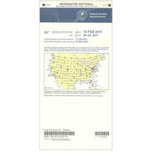
FAA Washington Sectional - 05/14/26 thru 07/09/26
Regular price $8.50Sale price $8.50 Regular priceUnit price per$9.75 -
 SaleVendor:AeroNav Products
FAA Miami VFR Sectional Aeronautical Chart - 05/14/26 thru 07/09/26
Regular price $8.50Sale price $8.50 Regular priceUnit price per$9.75 -
 SaleVendor:AeroNav Products
FAA Great Falls VFR Sectional Aeronautical Chart - 05/14/26 thru 07/09/26
Regular price $8.50Sale price $8.50 Regular priceUnit price per$9.75 -
 SaleVendor:AeroNav Products
FAA San Francisco VFR Sectional Aeronautical Chart - 05/14/26 thru 07/09/26
Regular price $8.50Sale price $8.50 Regular priceUnit price per$9.75 -
 SaleVendor:AeroNav Products
FAA Chicago VFR Sectional Aeronautical Chart - 05/14/26 thru 07/09/26
Regular price $8.50Sale price $8.50 Regular priceUnit price per$9.75 -
 SaleVendor:AeroNav Products
FAA Los Angeles VFR Sectional Aeronautical Chart - 05/14/26 thru 07/09/26
Regular price $8.50Sale price $8.50 Regular priceUnit price per$9.75


-
 FREE U.S. Shipping (on $100+)Save on outbound delivery!
 -
 4.8/5 StarsReviewed by 26,000+ Fellow Pilots
 -
 Expert Pilot SupportGear Tested by Real Pilots
 -
SHIPS TODAY (Order by 3 PM ET)Get It Faster!
- Choosing a selection results in a full page refresh.
- Opens in a new window.